Our expert Timor-Leste based team handpick all travel destinations and Timor-Leste accommodation on this site.
Handpicked Timor-Leste tours, local insider tips, and activities for you, with our best price guarantee. We are here to help.

Expert assistance before, during, and after your trip to Timor-Leste. With Australian and Timorese teams ready to assist.
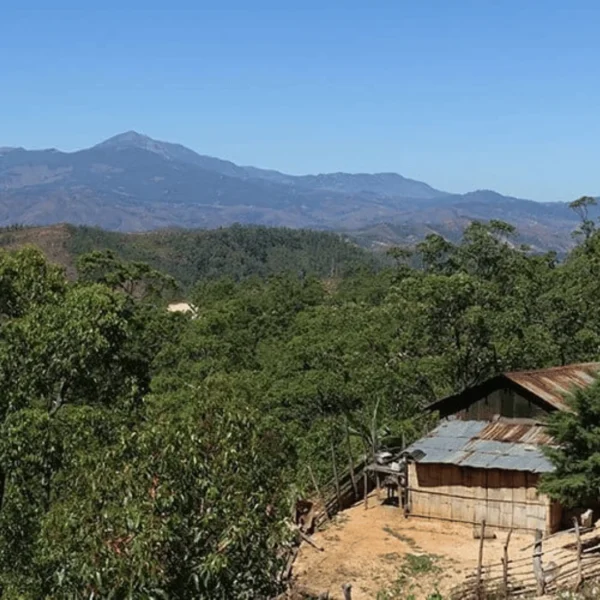
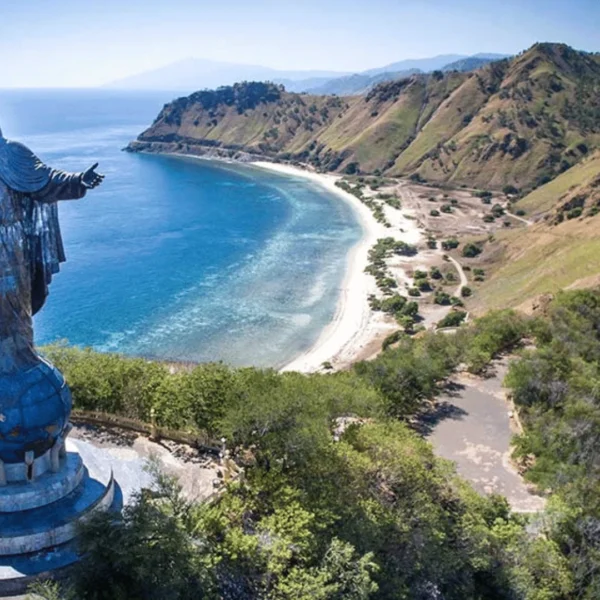
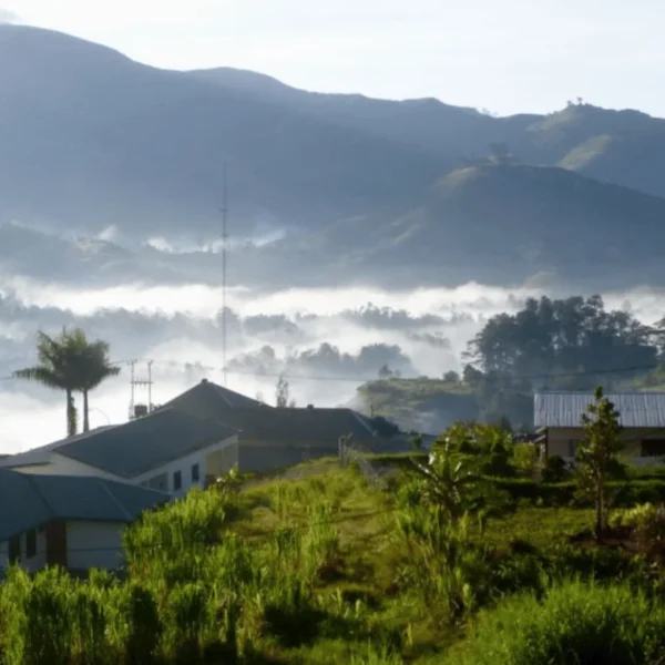
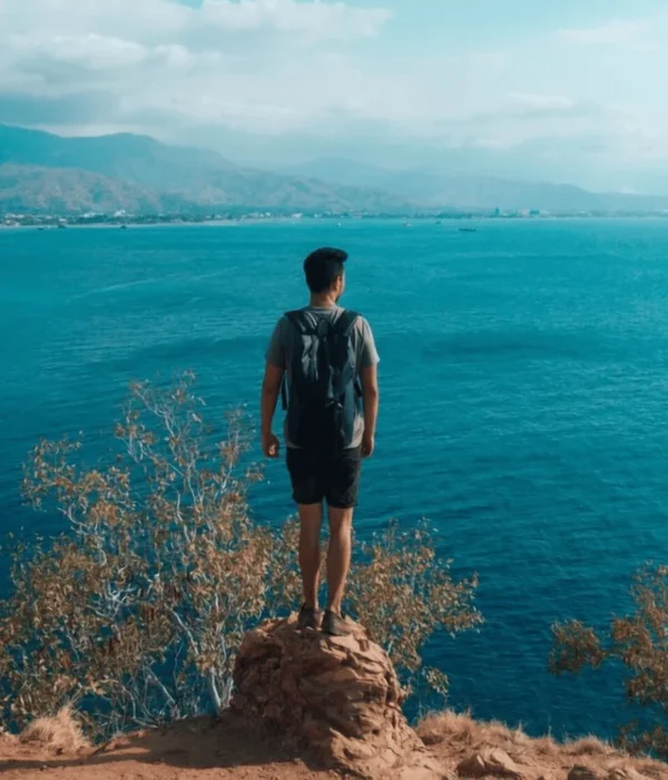
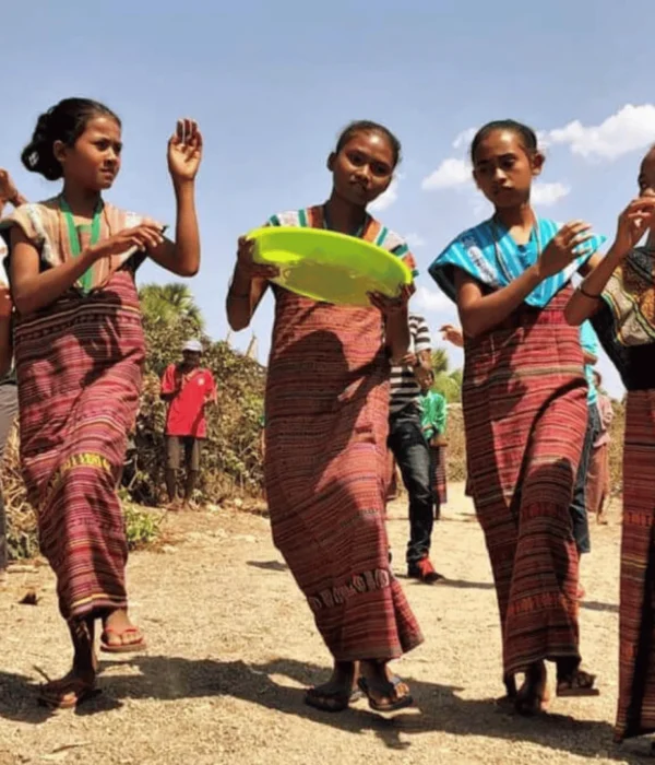
Timor-Leste is a hidden gem waiting to be discovered, offering pristine beaches, vibrant marine life, and a rich cultural heritage. From breathtaking mountain vistas to the welcoming local communities of Timor-Leste, it’s a destination perfect for adventurous Australian travellers and cultural enthusiasts alike.
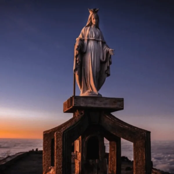
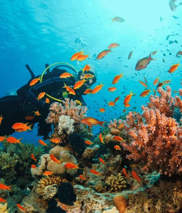
Explore the diverse landscapes of Timor-Leste, from lush rainforests to ancient sacred sites, and immerse yourself in the island’s unique blend of history and tradition. Whether diving in crystal-clear waters or hiking rugged terrains, Timor-Leste promises unforgettable experiences. Be sure to enjoy the famous Timor-Leste coffee roasts and visit the art markets.
Explore the most sought-after travel experiences across Timor-Leste with our curated selection of popular tours. Travel Timor-Leste uses your search to easily browse tours and select from multi-day adventures to scenic East Timor day trips, ensuring your Timor journey is perfectly tailored to you. Choose from our range of trusted tour agents; Manny Tours, Compass Diving, Eco Discovery, Dive Timor Lorase, Timor Unearthed, Sunshine Divers and more for an unforgettable travel experience for everyone.
Each tour listing provides detailed itineraries, traveler reviews, and a range of beautiful images so you can confidently pick the best route for you. Whether you’re drawn to the vibrant coral reefs off Timor’s coast, the challenging ascent of Mount Ramelau, or immersive cultural encounters in traditional villages within Leste, our platform simplifies discovering and booking the perfect Timor-Leste experience. Find your ideal East Timor adventure and secure your spot with just a few clicks, making your travel dreams to Timor-Leste a reality.
*Terms & Conditions applied


I highly recommend Manny Timor Tours. They were professional, friendly, well organised and reliable. Our group of ten (including kids and older adults) did day tours to Dili, Maubisse and Aileu. They were flexible, accommodated extra stops, and extended transport when needed. Lito (aka Manny), Carmen, Alex, Joko and Erni were all a pleasure to deal with.

Established in 2005, Eco Discovery are one of the longest running and most reputable tour operators in Timor-Leste. They are Timorese owned and operated. I’ve been on multiple trips with them, from day adventures, to an 8 day epic crossing the country on foot. They are well organised, responsive, and know Timor-Leste as well as anyone. They can organise pretty much any type of trip, and have the greatest experience of any Timorese operators in running hiking trips.

I’ve used Compass Diving multiple times for diving, snorkelling, transport, accommodation on Atauro, and whale watching. They’re always friendly, professional, and safety-focused. They catered wonderfully to my whole family—from my 70-year-old dad to my 10-year-old. Accommodation was basic but comfortable, food was great, and staff were knowledgeable and welcoming. We’ve had fantastic experiences and would definitely return.

I did both a snorkelling trip and my PADI open-water certification with Dive Timor Lorasae. The team made booking and scheduling easy. Giovanni, a marine biologist, led an amazing snorkel trip, and Selina was a patient, knowledgeable instructor for my dives. The reefs were pristine and uncrowded, with incredible biodiversity. We had delicious lunches (including vegan options) during full-day trips to beautiful dive sites. I’m so happy I got certified here—huge thanks to Selina and the team for an unforgettable experience!

Professional and passionate diving service with a wide range of dive types including whale and dolphin watching trips.
Embark on your journey of discovery with our comprehensive Travel Guides to Timor-Leste, designed to enhance every aspect of your adventure. Travel Timor-Leste offers a wealth of expertly curated information, allowing you to explore distinct regions and experiences across East Timor before you even pack your bags, guiding your Timor adventure.
From detailed insights into Dili’s vibrant markets and historical sites to practical advice for exploring the pristine natural beauty of remote areas in Leste, our guides provide essential knowledge for your Timor-Leste travel experience. In this section we cover accommodation, local customs, transportation within Timor, and must-try culinary delights from Leste, ensuring you’re well-prepared for an unforgettable immersion into the unique culture and landscapes of Timor-Leste in our up to date blog posts.


An essential resource for planning travel to Timor-Leste. We’ve compiled the most common enquiries to provide quick, clear and concise answers. We cover topics such as; Entry Requirements & Practicalities, Getting Around, Accommodation, Food & Drink, Top Attractions & Activities, Off the Beaten Path Recommendations, Cultural Etiquette, Health & Safety, Budget & Money, Sustainable Tourism and so much more general information about the hidden gem of East Timor.
Whether you’re curious about the best time to visit Timor-Leste, seeking details on local transportation options throughout Timor, or wondering about unique cultural experiences in Timor-Leste, this section is designed to equip you with the knowledge you need. Explore our FAQs to find out everything you need to know about Timor-Leste travel, allowing you to maximize your discovery of this extraordinary destination.
Timor-Leste, also known as East Timor, is a sovereign country in Southeast Asia. It occupies the eastern half of the island of Timor, along with the Oecusse exclave on the northwestern side of the island (within Indonesian West Timor), and the small islands of Atauro and Jaco. It’s situated northwest of Australia, across the Timor Sea, and east of Indonesia making it only 1 hour and 20 minutes away and one of the closest countries to Australia. Timor-Leste is a hidden gem nestled between the Indian and Pacific Oceans.
They are the same thing!
“East Timor” was the common name used internationally, particularly during the Indonesian occupation and the struggle for independence. “Timor-Leste” is the country’s official name. In Portuguese (Timor means “East” in both Portuguese and Malay, and Leste means “East” in Portuguese), adopted upon achieving full independence in 2002. You’ll hear both, but Timor-Leste is the formal and preferred term by its people.
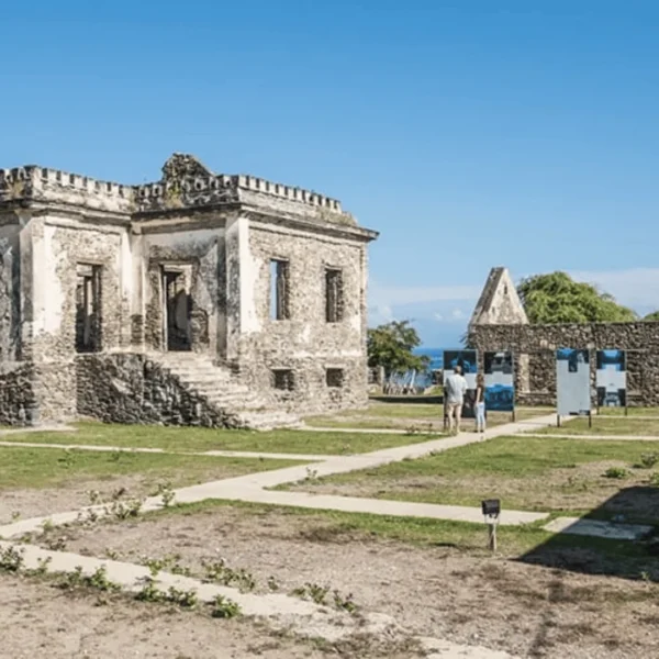
Timor-Leste has a rich history. It was a Portuguese colony for over 400 years, which has left a distinct cultural and architectural imprint. After Portugal’s withdrawal in 1975, Indonesia invaded and occupied the territory for 24 years, a period marked by significant conflict and loss. A UN-sponsored referendum in 1999 led to an overwhelming vote for independence, which was formally restored in 2002 after a period of UN administration. It’s a young nation with an ancient soul, and understanding this history adds immense depth and understanding to your visit.
To learn mor about Timor-Leste’s Heritage & Culture read more here.
Timor-Leste has two official languages: Tetum and Portuguese.
Tetum is the most widely spoken indigenous language, you’ll hear it throughout all of Timor-Leste.
Portuguese is generally used in government, legal and other formal affairs a legacy of its colonial past.
Bahasa Indonesia is also widely understood, especially by those who lived through the occupation.
English is increasingly spoken, particularly in Dili and among younger generations and those working in tourism.
However, you’ll find that learning a few basic Tetum phrases like “Bondia” (Good morning), “Diak ka lae?” (How are you?), and “Obrigadu/Obrigada” (Thank you, male/female speaker) will be warmly received.
The official currency of Timor-Leste is the US Dollar (USD). This makes it quite convenient for many international travelers. You’ll find that prices for everyday items are often quoted in dollars and cents. It’s wise to carry a mix of denominations, including smaller bills, as change can sometimes be scarce outside of larger establishments in Dili.
Timor-Leste has a tropical climate, characterized by distinct wet and dry seasons. The Dry season generally runs from May – November, offering sunny days and cooler evenings, especially in the mountains. This is typically the most popular time to visit. The Wet season, from December – April, brings heavier rainfall, which can sometimes make travel to remote areas challenging due to road conditions, but also results in incredibly lush, green landscapes. Coastal areas are generally hot and humid year-round, while the mountainous interior can be surprisingly cool, particularly at night.
For most travelers, the Dry season (May – November) is ideal. You’ll experience the most reliable weather for outdoor activities like diving, hiking, and exploring the coastline. June – August are often considered peak months within the dry season, with pleasant temperatures and minimal rain. However, if you’re interested in seeing the landscapes at their greenest or experiencing fewer crowds, the shoulder months (April – May or October – November) can also be rewarding, though you might encounter occasional showers. I’ve visited in both seasons, and while the dry season is easier logistically, the wet season reveals a different, more verdant beauty, especially in the coffee-growing highlands.
Yes. For many nationalities, including Australians, New Zealanders, and citizens of EU countries, a tourist visa can be obtained on arrival at Dili’s Presidente Nicolau Lobato International Airport or the Dili seaport. This is typically a 30-day single-entry visa, often costing around $30 USD (cash is essential, and exact change is preferred). It’s always best to check the latest visa requirements with the Timor-Leste embassy or consulate in your country before you travel, as regulations can change. Ensure your passport has at least six months of validity remaining from your intended date of departure from Timor-Leste.
The primary international gateway is Presidente Nicolau Lobato International Airport (DIL) in Dili. Direct flights are available from Darwin (Australia), Denpasar (Bali, Indonesia), and Singapore. Airlines like Airnorth, Citilink, and Aero Dili operate these routes. From my experience, the flight from Darwin is incredibly short (1 hour & 20 minutes), making Timor-Leste a surprisingly accessible destination from northern Australia.
Mobile coverage is quite good in Dili and other major towns, but it can be patchy in remote and mountainous regions. Timor Telecom, Telemor, and Telkomcel are the main providers. You can easily purchase a local SIM card upon arrival at the airport or in Dili. This is very affordable and the best way to stay connected. Internet access is available at most hotels and guesthouses in Dili, and increasingly in regional centers, though speeds can vary. Don’t expect lightning-fast connections outside the capital. It’s part of the charm of getting off the grid! We recommend a local SIM with a data package, which is sufficient for emails, maps, and basic browsing.
Yes, Timor-Leste is generally considered a safe country for travellers. The Timorese people are known for their warmth and hospitality. Like anywhere, it’s important to exercise common sense: be aware of your surroundings, secure your valuables, and avoid walking alone in unlit areas late at night. Petty theft can occur, but violent crime against tourists is rare. I’ve always felt remarkably safe during my travels, even in more remote areas. As it is a newer country and travel destinations you will find yourself welcomed warmly and with open arms from the locals.
It’s recommended to be up-to-date with routine vaccinations such as:
Additionally your yearly flu vaccine and depending on your travel style and duration, your doctor might also suggest Hepatitis B, Rabies, and Japanese Encephalitis.
Malaria is present in some parts of Timor-Leste, particularly in rural areas and during the wet season, so consult your doctor about anti-malarial medication. Dengue fever is also a risk, so take precautions against mosquito bites (use repellent, wear long sleeves/pants, especially at dawn and dusk). Always consult a travel doctor or clinic well in advance of your trip for personalised advice.
Larger hotels, some restaurants, and dive operators in Dili may accept major credit cards (Visa and Mastercard are most common), but it’s not widespread. We recommend to always have cash on you especially for markets and places outside the city. Outside of Dili, credit card facilities are very rare.
ATMs are available in Dili, and a few in major towns like Baucau. However, It is recommended to carry enough US dollars in cash to cover your expenses, especially if you plan to travel outside the capital. Make a withdrawal of sufficient cash in Dili before heading to more remote areas.
And last but not least – a sense of adventure and an open mind! This is key to enjoying Timor-Leste.
For an in depth packing essentials check list click here to read more.
Yes, you can rent cars, particularly 4WD vehicles, in Dili. Several local companies and some international agencies (though fewer) offer rentals. Renting with a local driver is often advisable and sometimes mandatory, especially if you are unfamiliar with the roads or local driving customs. Drivers not only navigate but can also act as informal guides and translators. Self-drive is possible, but ensure you have a valid international driving permit, comprehensive insurance, and are comfortable driving on potentially rough and poorly signposted roads. I’ve done both, and while self-drive offers freedom, having a local driver significantly reduces stress and often leads to more interesting local encounters.
Taxis are common in Dili.
You can hail them on the street or find them at designated taxi stands or hotels. Remember to agree on the fare before you start your journey. Formal ride-sharing services like Uber or Grab are not currently operating in Timor-Leste. However, some local drivers may offer ride services, which you could arrange through your accommodation or local contacts.
Public transportation consists of Buses and Mikrolets that connect Dili to major towns and districts. These are the most budget-friendly options. They are a fantastic way to experience local life. For travel to more remote areas, public transport options become scarcer and less reliable. Always confirm departure times and routes locally, as may change.
Road conditions can vary. The main roads connecting Dili to major towns like Baucau, Suai, and Maliana have undergone recent development and repaving. However, once you venture off these main routes, roads can become rough, unpaved, and a bit challenging in some areas. Ensure safety during and after the wet season when landslides can occur and take main routes. A 4WD vehicle is recommended for exploring much of the country’s interior and more remote coastal areas.
Always allow for flexibility in your itinerary, as unexpected delays may occur.
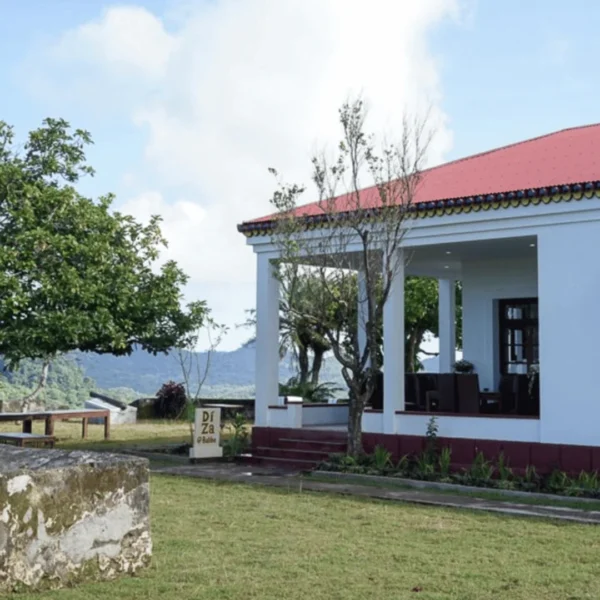
Accommodation options range from hotels and guesthouses to simple homestays, eco-lodges, and basic guesthouses in regional areas.
In Dili, you’ll find everything from budget backpacker hostels to comfortable mid-range hotels and a few more upscale options. Outside the capital, choices become more limited but offer more authentic local experiences. However, you’ll still find some nice options in the main towns.
On Atauro Island, for example, community-run eco-lodges are popular and beautiful. Many of the tour and diving companies also offer accommodation on the island as well as the transfer over there.
This depends on your budget and preferences. The Lecidere area (waterfront) is popular, with several hotels offering sea views and easy access to restaurants. Areas around the Palácio do Governo and the embassies also have good options. For budget travelers, there are several well-regarded backpacker hostels. There are also options of locally-owned guesthouses for a more personal touch.
To find out more read our accommodation page.
Yes!
While Dili has the widest range, you can find guesthouses, homestays, and smaller hotels in most district capitals like Baucau, Maubisse, Same, Suai, and Maliana as well as a few up market options. Atauro Island has a good selection of eco-lodges and guesthouses. Places like Jaco Island involve more rustic camping-style stays on the mainland opposite the island as well as some guesthouses. Exploring beyond Dili and staying in local accommodation is key to experiencing the country’s diversity.
It’s highly preferred to book in advance, especially if traveling during peak season (June – August) or if you have specific preferences. In Dili, you have more options, but popular places can fill up quickly. Outside of Dili, accommodation can be limited, so booking ahead is wise to avoid disappointment. For very remote areas or homestays, arrangements might be made more informally upon arrival or through local contacts, but having a plan B is always good.
Yes, and these are some of the most rewarding places to stay!
Atauro Island is particularly known for its community-based eco-lodges that directly benefit local villagers and focus on sustainable practices. Several initiatives are also developing in other parts of the country, offering authentic cultural experiences and supporting local livelihoods. These often provide a more intimate experience with Timorese culture and nature. Ask around, or check with local tourism operators for the latest options. Ecolodges such as Barry’s Place on Atauro are great options.
Timorese cuisine is a fascinating blend of Southeast Asian flavors with Portuguese influences, reflecting its history. Staples include rice, corn, root vegetables (like cassava and sweet potato), and legumes. You’ll find plenty of fresh seafood along the coast, while pork and chicken are common meats. Dishes are often flavored with local herbs and spices, tamarind, coconut milk, and chili. It’s generally hearty, wholesome, and not overly spicy unless you ask for extra chili (which is readily available!).
Traditional dishes include:
Dili offers a surprising variety of dining options. For authentic Timorese food, look for local eateries (warungs) or ask for recommendations from your guesthouse – these often provide the most genuine and affordable meals. Along the Areia Branca beach, you’ll find numerous restaurants grilling fresh seafood in the evenings, which is a fantastic experience. There are also several international restaurants catering to expats and tourists, offering Portuguese, Italian, Chinese, and other cuisines.
It is generally not recommended to drink tap water in Timor-Leste, especially for visitors whose stomachs aren’t accustomed to it.
Bottled water is widely available and affordable. Many hotels and guesthouses also provide filtered water or boiled water. To be environmentally conscious, consider bringing a reusable water bottle and a portable water filter or purification tablets.
While Timorese cuisine traditionally features meat and fish, vegetarian options are usually available, especially if you ask. Rice and vegetable dishes are common. Tofu and tempeh can sometimes be found, particularly in places with Indonesian influence. In Dili, some international restaurants may have dedicated vegetarian or vegan menu items. However, in more remote areas, choices might be limited, so it’s good to be flexible and communicate your dietary needs clearly.
Timor-Leste produces some exceptional organic Arabica coffee, grown in the cool mountain highlands of the Ermera region as well as Ainaro, Maubisse, Aileu, Manufahi, Liquica, and Bobonaro districts. It’s a significant export and a source of pride. You can enjoy locally grown coffee in cafes in Dili, some of which roast their own beans. For a real experience, visit a coffee plantation in areas like Maubisse or Ermera to see the process from bean to cup. The coffee is typically strong, smooth, and flavorful. Bringing home a bag of Timorese coffee makes for a great souvenir. I always start my days in Timor-Leste with a cup of their robust local brew.
Like anywhere you should exercise the usual precautions you would when traveling in any tropical countries. We recommend you eat at places that look clean and busy. Be cautious with street food if you have a sensitive stomach, though many local snacks are very safe and delicious and definitely worth the try. Ensure that cooked food is served hot. Peel fruits yourself or wash them thoroughly with safe water. If in doubt, stick to dishes that are generally served hot and bottled or purified water.
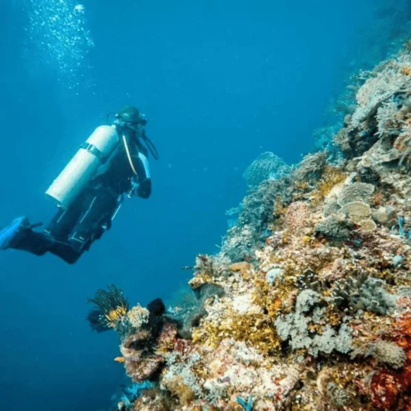
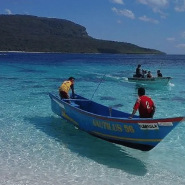
Timor-Leste is a world-class diving and snorkeling destination.
Atauro Island is consistently ranked as having some of the most biodiverse coral reefs on the planet. You can expect incredible visibility, vibrant coral gardens, and a vast array of marine life, from tiny critters to large pelagics.
Dive operators in Dili and on Atauro offer courses, fun dives, and snorkeling trips. Even snorkeling directly from the shore in many locations can be spectacular. The north coast also has numerous excellent dive sites. It’s an underwater photographer’s dream.
It is always respectful to ask permission before photographing people, especially in villages or during ceremonies. Some people may be uncomfortable being photographed, while others may be delighted. Sacred sites, military installations, and government buildings should not be photographed without permission. If someone agrees to be photographed, it’s nice to show them the image afterward and, when possible, find a way to share them!
Always ensure to check the areas your travelling to to find local healthcare and clinics in case of emergency. Dili has the best medical facilities in the country, including the National Hospital and a few private clinics. Outside of Dili, healthcare can be limited, so be sure to check for local district hospitals and health centers in your area. Before leaving your country, make sure you receive comprehensive travel insurance with medical evacuation coverage.
To read more about what to do in the unlikely event of an emergency find more information on our blog post Timor-Leste Emergency Services.
Malaria is present in Timor-Leste, particularly in rural areas and during the wet season. Risk is lower in Dili but still exists. Consult a travel doctor before your trip about appropriate anti-malarial medication. Regardless of medication, take precautions against mosquito bites: use repellent containing DEET or Picaridin, wear long sleeves and pants (especially at dawn and dusk), sleep under mosquito nets, and use air conditioning where available. Dengue fever is also present and has no preventive medication, so mosquito bite prevention is crucial.
Cell phone coverage can be patchy outside urban areas, so have alternative communication plans for remote travel.
Read more here.
Timor-Leste is still affordable by Western standards. However, the use of the US dollar means there’s no favorable exchange rate advantage for many travelers. Imported goods can be more expensive, while locally produced items and food from local markets are reasonably priced.
Since Timor-Leste uses USD ($), you won’t need to exchange money if you bring USD. If you have other currencies, you can exchange them at banks in Dili (Banco Nacional Ultramarino, ANZ, or Bank Mandiri) or at authorized money changers. Exchange facilities outside of Dili are very limited, so it’s best to handle currency exchange in the capital.
Learn more about where to find banks and exchange money here.
ATMs are available in Dili, with several located around the central areas, major hotels, and the airport. There are also ATMs in some district capitals like Baucau, but they are much less common outside of Dili. ATMs can sometimes run out of cash or be out of service, so it’s advisable to withdraw sufficient funds while in Dili before traveling to remote areas. Most ATMs dispense USD ($) and accept major international cards (Visa and Mastercard primarily).
Find out more about where to find ATM’s here.
Tipping is not traditionally expected in Timor-Leste, but it is becoming more common in tourist-oriented services. In restaurants, rounding up the bill or leaving 5-10% for good service is appreciated but not required. For guides, drivers, or others who provide exceptional service over multiple days, a tip is a nice gesture. Use your judgment based on the quality of service and your satisfaction. We recommend to tip guides and drivers who go above and beyond, as tourism jobs are important for the local economy. However any type of tips will be received warmly.